Microgravimetry
Research devoted to interpretation of detailed microgravity surveys with applications in archaeological investigations or geohazards, aiming at detection of shallow cavities such as crypts, hidden rooms and bunkers at historical or cultural sites, or abandoned mine-workings at urban sites. Microgravimetry is combined with georadar wherever possible. Detailed topographic correction, so called building correction, for the effect of building walls and other architectural features is calculated using an in-house program Polygrav that utilizes 3D polyhedral models reconstructed from photographs in special photogrammetric software.
Combined geodetic and geophysical modelling of a religious edifice
Written by Jaroslava Pánisová | Published in: Microgravimetry |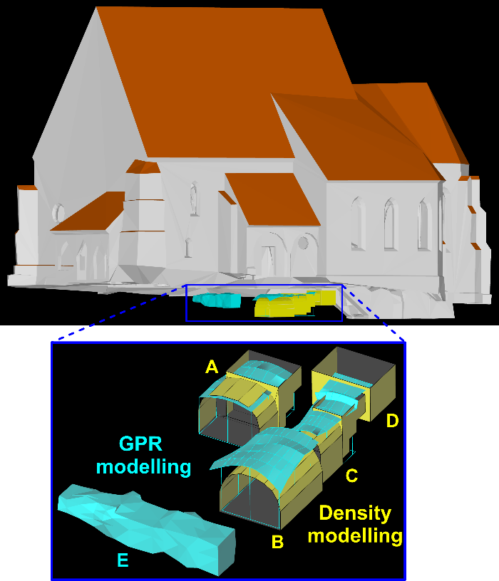
The implementation of geophysical methods in the monitoring of built heritage offers a valuable, non-destructive insight into the internal structure. We have shown that 2D geophysical images or quantitative interpretations in form of 3D models can be easily incorporated into virtual databases of documented built heritage contributing to the understanding of its historical development also by the public and non-experts. Such multidisciplinary approach to sense the present and past of our historic monuments contributes significantly to their documentation for future generations.
Polyhedral approximation of buildings in microgravity data processing
Written by Jarka | Published in: Microgravimetry |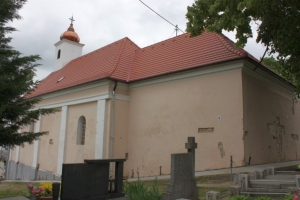
Microgravity surveys for cavity detection conducted in the interior of buildings require high accuracy during data acquisition and modern processing procedures. We have developed a new method for the calculation of building effects, where geodetic measurements and photogrammetric software PhotoModeler are used. The advantages of the new approach are demonstrated on a small Slovak church, where two crypts were detected using microgravity and GPR methods in summer 2009. We have shown that close-range photogrammetry methods offer a possibility to improve the microgravity data processing.
Geophysical survey of the St. Catherine’s church, Slovakia
Written by Jarka | Published in: Microgravimetry |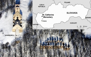
The ruins of the St. Catherine's monastery complex are an important example of Slovak cultural heritage. An integrated geophysical approach to detect and characterize subsurface archaeological features has been applied in the nave of the former church. The combination of microgravimetry and GPR is shown to be a very effective tool for such mapping. Results from 36 GPR profiles were visualized in the form of horizontal time-slices and vertical time-sections. Several gravity anomalies were found in the residual Bouguer anomaly map. Semi-automated interpretation techniques including the Euler deconvolution and harmonic inversion were used to investigate the depth and shape of anomalous sources.