11/09 2017
Combined geodetic and geophysical modelling of a religious edifice
Published in:
Microgravimetry
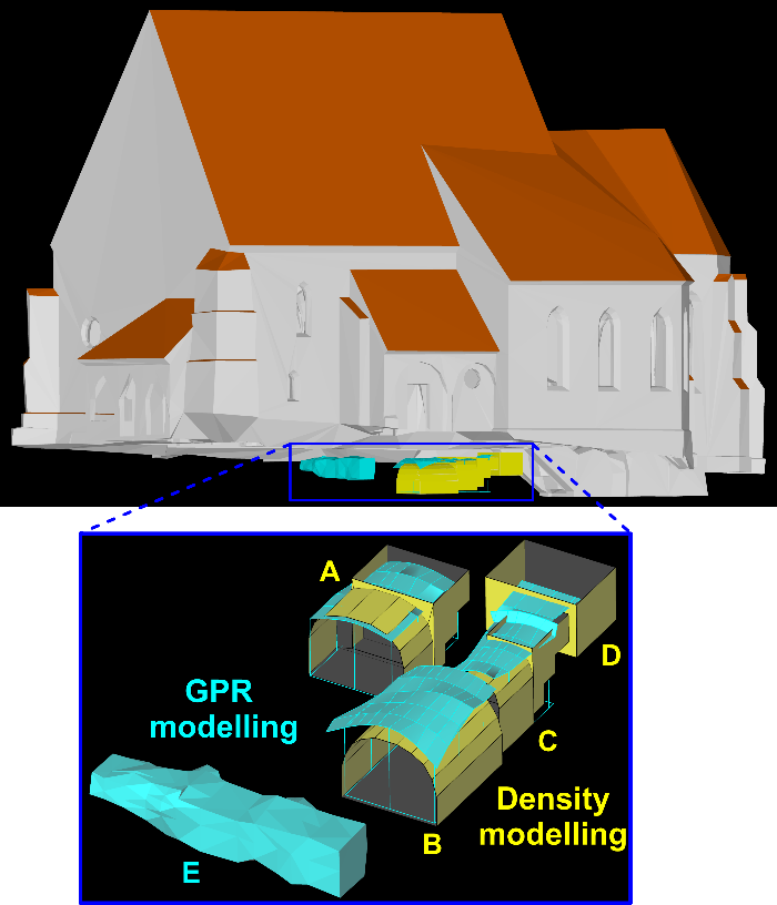
The implementation of geophysical methods in the monitoring of built heritage offers a valuable, non-destructive insight into the internal structure. We have shown that 2D geophysical images or quantitative interpretations in form of 3D models can be easily incorporated into virtual databases of documented built heritage contributing to the understanding of its historical development also by the public and non-experts. Such multidisciplinary approach to sense the present and past of our historic monuments contributes significantly to their documentation for future generations.