Jaroslava Panisova1, Marek Fraštia2, Tina Wunderlich3 and Roman Pašteka4
1 Geophysical Institute, Slovak Academy of Sciences, Bratislava, Slovakia,
This email address is being protected from spambots. You need JavaScript enabled to view it.
2 Department of Surveying, Slovak University of Technology, Bratislava, Slovakia
3 Institute of Geosciences, Christian-Albrechts-University, Kiel, Germany
4 Department of Applied and Environmental Geophysics, Comenius University, Bratislava, Slovakia
Introduction
The use of the microgravity method for cavity detection in the exploration of historical buildings requires the calculation of additional corrections that take into account the gravitational effects of surrounding man-made structures (buildings, known underground spaces). Digital photogrammetry is widely applied in archaeological investigations and the preservation of architectural heritage. The capability of close-range photogrammetry to improve microgravity data processing was introduced in [4], where a new method for calculating building corrections based on photogrammetric reconstruction was used. The following case study demonstrates the application of this method with a microgravity survey undertaken at the Slovak archaeological site of St. Catherine's.
Site description
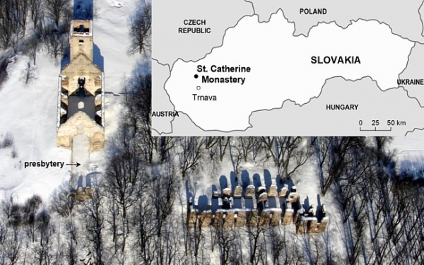
The ruins of St. Catherine's monastery are located on a rocky hill in the woods of the Little Carpathians in western Slovakia, 20 km northwest from Trnava. The geology of the site consists of Middle Triassic carbonates (light-coloured massive limestones of the Nedzov nappe) and Quarternary sediments. The Franciscan monastery was founded in 1618 in an area where the Gothic chapel from the 15th century was situated. It was a famous site of religious significance due to the legends describing the apparitions of St. Catherine of Alexandria. The original monastery church was rebuilt in 1646 to a larger Early Baroque edifice with dimensions of 52 × 13.5 m and with a 30 m high tower. The monastery complex was abolished by the order of the Emperor Joseph the Second in 1786 [3].
The restoration of the ruins started in 1994. The preservation project of the monastery is organized by a local civil association (www.katarinka.sk). In the framework of this project, complex historical, archaeological, anthropological and geophysical research has been conducted at the site since 1997 [3]. The main objective for geophysical survey was to identify potential areas for further archaeological research.
Photogrammetric processing
The convergent multi-station photogrammetric method was used for the digital spatial reconstruction of the church. The images were taken with digital cameras Olympus C-8080 and Nikon D-200. Both cameras were calibrated in the test and calibration field [1] before image acquisition. The photogrammetric processing of the project was carried out using the PhotoModeler 6 software (www.photomodeler.com). Exterior and interior parts of the church have been processed separately. Both parts were combined into one project using control points measured by a total station.
Because it was impossible to use the photogrammetric methods in the interior of the tower due to its narrow and elongated shape, a different approach had to be selected. A Trimble VX total station with built-in camera was used to measure the interior of the tower from the ground. The entire vector model displayed in Fig. 1a includes all surfaces of interior and exterior parts of the church and the tower (8148 triangular faces). A total model accuracy of 0.018 m (a spatial mean error) calculated from all points was achieved.
Microgravimetry
The microgravity survey was undertaken to investigate the area inside the former church, where along with the known medieval crypt excavated in 2001 (plan view in Fig. 2; [6]) another two crypts are supposed to be located. This area was surveyed on a closely spaced grid of 258 stations with a point spacing of 1 m (Fig. 1b). A Scintrex CG-5 gravimeter was used to acquire the gravity data. The instrumental drift was estimated by regularly repeated readings at a selected base station at hourly intervals. Statistical analysis of the repeated stations from different days provided a mean squared error of less than 4 µGal.
Subsequent data processing included free-air, planar Bouguer, topographic and building corrections. The terrain corrections were computed up to 5.24 km. A density of 2.4 g/cm3 was used for the calculation of the planar Bouguer and terrain corrections. The final model of the church (Fig. 1a) served as the direct input to program Polygrav for the calculation of the building correction [4] that is based on the 3D polyhedral body approximation introduced by [2]. The building correction (Fig. 1b) was calculated for a mean density of 2.2 g/cm3. The results from the microgravity survey are displayed in the form of a residual Bouguer anomaly map (Fig. 2a), with the regional trend removed.
The harmonic inversion method [5] enables us to find the position and shape of a set of anomalous bodies embedded in an a-priori known horizontally layered background. The method provides several admissible subsurface density models for the residual gravity field, so the comparison with other interpretation techniques as well as other geophysical methods is necessary to select the most feasible one. The structural index in Euler deconvolution related to the attenuation with distance of the potential field was set to one, thus detecting a horizontal cylinder in gravimetry.
In Fig. 2c, the density distribution for 1.8 m depth obtained by means of harmonic inversion is displayed, along with the Euler deconvolution solutions denoted by filled circles. Fig. 2d shows selected vertical sections of the density model in two profiles crossing the main gravity low produced by the known crypt. The average depths (approximately 1.6–2.0 m) of the solution cluster fit into the estimated depths of the air-filled crypt obtained by means of the harmonic inversion method.

Fig. 1: a) The polyhedral model of the church. b) The calculated building correction in mGal displayed within the plan of the church.
Ground penetrating radar
In order to eliminate the ambiguity inherent in microgravity method, the residual Bouguer anomaly map was overlapped and compared with GPR results from eastern part of the nave (Fig. 2b). GPR measurements were taken using a GSSI SIR-20 system with a 400 MHz antenna. 36 GPR profiles were acquired in zig-zag mode with 0.15 m line spacing. For time/depth conversion, the wave propagation velocity was estimated by diffraction hyperbola fitting with an average value of 0.09 m/ns. Processing steps for each profile consisted of t0-corrections, offset removal, direction ordering and the creation of time-slices.
In the GPR horizontal time-slice (Fig. 2b) two distinctive reflection anomalies indicate the existence of two features of archaeological interest. The GPR time-section presented in Fig. 2e (Profile A in Fig. 2b) corresponds to about 0–3.2 m in depth. The top of the known air-filled crypt (C1) is indicated by a strong almost horizontal reflection, which is caused by the dielectric permittivity contrast between soil or concrete and air. The hyperbolic reflection below is caused by a post, which was installed to support the concrete cover protecting the excavated crypt [3]. The second, almost horizontal reflection at about 25 ns can be interpreted as the bottom of the crypt, taking the high velocity in air (0.30 m/ns) into account. The chaotic reflection patterns of features C2 and C3 suggest that the expected crypts are destroyed and filled by debris. The depth to the top of these crypts is estimated to be around 0.5 m.
The vertical density section (Profile A, Fig. 2d) can be correlated with features seen on the GPR vertical time-section (Fig. 2e). For the air-filled crypt excavated in 2001, the dimensions (5×1.9×2 m) and position (its top is situated in a depth of 0.6–0.8 m below the ground) have been confirmed by both geophysical methods. The other two features, which were successfully detected and delineated by both methods, most likely relate to two crypts documented in historical archives. The GPR and microgravity results indicate that these two objects could be partially filled. Recommendations for archaeological excavation were given to the site-excavators.
Conclusions
This case study illustrates the advantage of combining geophysical methods that are based on different physical parameters. The combination of microgravity and GPR surveys has proved to be a very effective and non-destructive tool for archaeological research. The geophysical results obtained could be incorporated to the virtual databases, where valuable monuments are documented for next generations. We have shown that the digital models of the historical buildings can be directly utilized for the calculation of their gravitational effects in microgravimetry. A novel approach of microgravity data processing is designed particularly for archaeological applications.
References
- 1. Fraštia M. 2005. Possibilities of using inexpensive digital cameras in applications of close-range photogrammetry. Slovak Journal of Civil Engineering 8(2): 20–28.
- 2. Götze HJ, Lahmeyer B. 1988. Application of three-dimensional interactive modeling in gravity and magnetic. Geophysics 53(8): 1096–1108.
- 3. Herceg P. 2009. Experiences with the restoration of St. Catherine’s monastery ruins. 15 years of St. Catherine’s monastery preservation project near Dechtice village. Association of the Christian Youth Communities: Spišská Nová Ves. (In Slovak.)
- 4. Panisova J, Pašteka R, Papčo J, Fraštia M. 2012. The calculation of building corrections in microgravity surveys using close range photogrammetry. Near Surface Geophysics 10(5): 391–399. DOI: 10.3997/1873-0604.2012034.
- 5. Pohánka V. 2003. The harmonic inversion method: calculation of the multi-domain density. Contrib. Geophys. Geod. 33(4): 247–266
6. Urminský J. 2002. Continuation of the investigation of St. Catherine’s monastery near the Dechtice village. Archaeological explorations and finds in Slovakia in 2001: 215–216. (In Slovak.)

Fig. 2: a) The residual Bouguer anomaly map in mGal. b) The GPR horizontal time-slice stack between 20–40 ns (approx. 0.9–1.8 m depth) displayed along with the residual Bouguer anomaly contours. c) The interpretation of microgravity results using the harmonic inversion and Euler deconvolution methods for a depth of 1.8 m. d) The density distributions in two vertical sections for profiles A and B. e) The GPR vertical time-section (Profile A) running in SW-NE direction.
 pdf version to download
Original article available at Archaeological Prospection Journal