Geodynamics
Research devoted to the study of earth tides and crustal deformations, monitoring and interpretation of extensometric measurements. Special attention is paid to the aperiodic component of the extensometric data with implications to slow tectonic crustal deformations, and to the derivation of rheological properties of the earth crust.
We deal also with interpretation of surface deformations and gravity changes observed in active or awakening volcanic areas.
Slovak-Italian volcano-gravimetric campaign Etna 2018
Written by Peter Vajda | Published in: Geodynamics |Earth scientists from Slovakia, Pavol Zahorec and Peter Vajda of the department of gravimetry and geodynamics of the ESI SAS and Juraj Papčo of the department of theoretical geodesy of the Slovak University of Technology in Bratislava have teamed up with colleagues from Osservatorio Etneo, Instituto Nazionale di Geofisica e Vulkanologia (INGV) in Catania, Sicilia, Daniele Carbone, Filippo Greco, and Massimo Cantarero to conduct in July a one week campaign of field work devoted to volcano gravimetric measurements. The objective of this effort was to verify in–situ the newly developed methodology devoted to treating deformation–induced gravimetric effects in interpretation of spatio-temporal gravity changes observed and interpreted in volcanic areas that are used to learn as much as possible about magmatic and volcanic processes and to predict volcanic hazard and mitigate damages caused by eruptions or volcanic unrest. A curious by–product of our observations was the determination of the current elevation of Etna, which is a quantity changing in time due to eruptions, using geodetic GNSS (GPS).
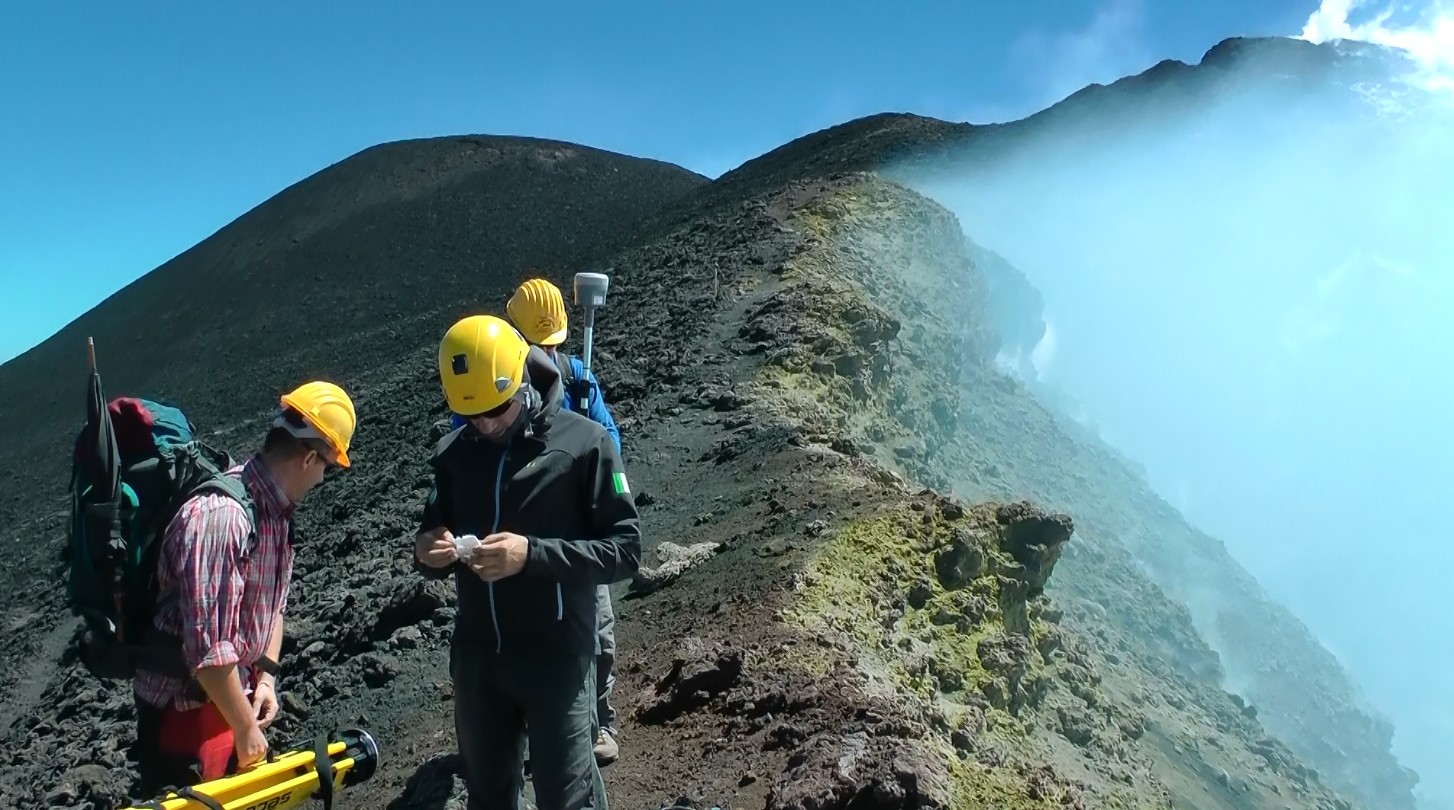
At the edge of the Bocca Nuova crater in the summit area of Etna (ca 3200 m a.s.l.)
Stratovolcano Etna is the largest and highest volcano in continental Europe, belonging to the 3 most active volcanoes in the world. Although it does not belong to the most dangerous volcanoes due its mostly effusive eruptive activity, it is one of the best monitored and studied volcanoes in the world (see web resources below). Volcanologists and geophysicists have learned to recognize spatiotemporal patterns and precursors in the monitored data from extensive networks, continuous and repeat–campaign measurements that are used to gain knowledge about magmatic and volcanic processes, as well as for prediction of volcanic hazards. Part of such data are also spatio-temporal gravity changes. And this is where our research takes part.
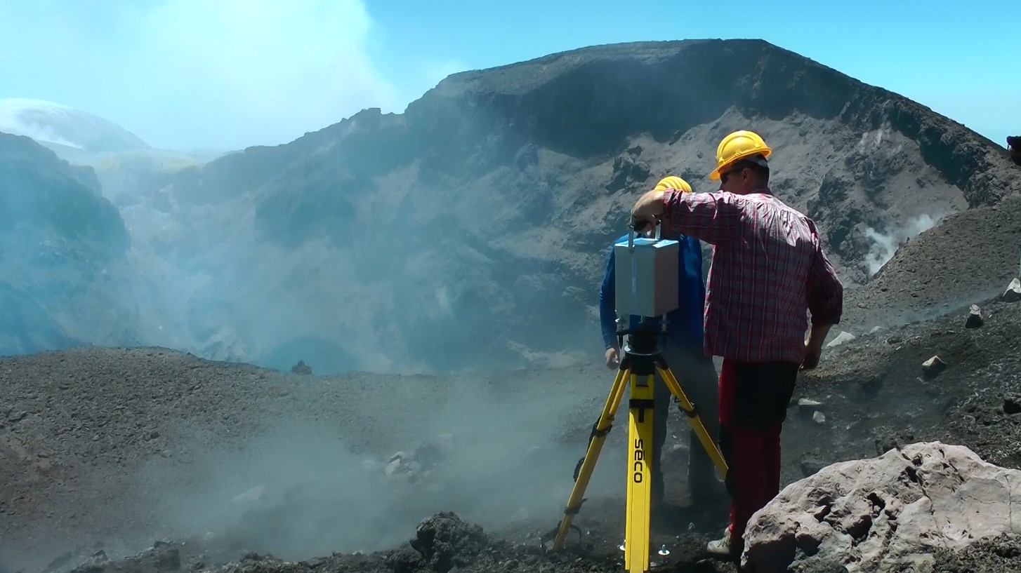
Gravimetric measurements at the edge of the NE crater, which exhibited during the day weak strombolian activity deep inside, and occasionally threw out volcanic bombs
To interpret properly the temporal gravity changes observed in volcanic areas, the gravity signal induced by surface deformations (elevation changes) accompanying the process taking place in the guts of a volcano must be removed, so that the residual signal is due to the migration or redistribution of subsurface magma (or its volatiles) that is to be interpreted from the gravity changes. This is standardly done by removing a free-air effect based on theoretical vertical gradient of gravity and a Bouguer effect approximating the attraction of deformed topographic surface. We are proposing a new approach that should be more exact, based on a gradient effect due to a predicted true vertical gradient of gravity (VGG) and an attraction term computed based on numerical Newtonian volumetric integration. Our field work was part of the effort to verify our new approach and to prove it correct and better. For that sake we needed to demonstrate that we can successfully predict the VGG in volcanic areas of prominent rugged topography based on modelling the topographic contribution to the VGG using high resolution high accuracy digital elevation models (DEM) and eventually local improvements using drone-flown photogrammetry.
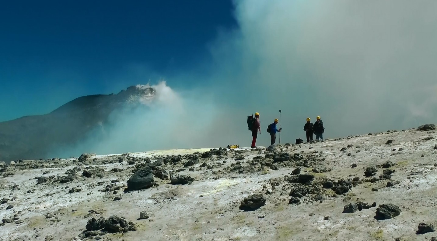
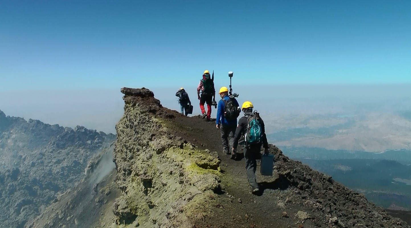
The engagement and the attractive yet demanding worksite environment in the summit craters area
Web resources about Etna and its geophysics and vulcanology:
Volcano-Gravimetric observations on Tenerife, 2016
Written by Peter Vajda | Published in: Geodynamics |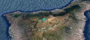
Researchers from the Earth Science Institute went to Tenerife in June 2016 to carry out volcano-gravimetric field work. The objective of the observation campaign was to measure in-situ vertical gradients of gravity (VGGs) for the sake of verifying the numerically predicted (modelled) extreme values of the VGG. The crew comprised Peter Vajda and Pavol Zahorec of the Department of Gravimetry and Geodynamics of our institute, as well as Juraj Papčo of the Department of Geodesy of the Slovak Technical University in Bratislava. The campaign span one week (20–28 June, 2016). This field work campaign was conducted successfully and the acquired data seem promising.
Temporal gravity changes and surface deformations interpretation
Written by Peter Vajda | Published in: Geodynamics |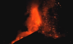
Measurable temporal changes of gravity and deformations of earth's surface are indicators of dynamic processes inside the earth, such as those associated with movements of magma preceding volcanic eruptions. The observation, analysis and interpretation of surface gravity changes and vertical displacements of the topographic surface contribute to understanding the physics of magma reservoirs and the processes associated with volcanic activity.
Interpretation of gravity changes at Mayon stratovolcano, Philippines
Written by Peter Vajda | Published in: Geodynamics |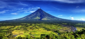
Peter Vajda1, Ilya Prutkin2, Robert Tenzer3 and Gerhardt Jentzsch2
1 Geophysical Institute, Slov. Academy of Sci., Bratislava, Slovakia,
This email address is being protected from spambots. You need JavaScript enabled to view it.
2 Institute of Geosciences, Jena University, Jena, Germany
3 National School of Surveying, University of Otago, Dunedin, New Zealand
Gravimetric picture of the 2004 volcanic unrest on Teide, Tenerife, Canary islands
Written by Peter Vajda | Published in: Geodynamics |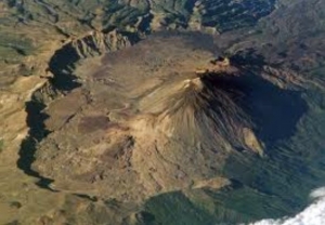
Gravity changes observed around Teide (Tenerife) between May 2004 and July 2005, due to the suspected reawakening of the volcano, were reinterpreted by us. Our objective was to seek multiple sources of the observed gravity signal. Our interpretation is based on the decomposition of the gravity signal into shallow and deep fields, and subsequent inversion of each field by means of 3D line segments. The shallow (near-surface) segments are interpreted as hydrothermal fluids. A short deep segment was found at the depth of about 6 km below sea level, interpreted as magma injection. Our results indicate that the 2004 volcanic unrest at the Central Volcanic Complex of Tenerife was a failed eruption.