Integrated lithospheric modelling in the Red Sea area
Radwan A. H. A. 1, Issawy E. A. 1, Dérerová J. 2, Bielik M. 2,3, Kohút I. 2
1National Research Institute of Astronomy and Geophysics
2Geophysical Institute of the Slovak Academy of Sciences
3Department of Applied and Environmental Geophysics, Faculty of Natural Sciences, Comenius University3
Introduction
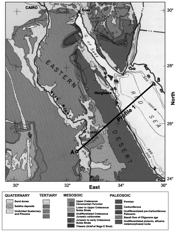
The Red Sea is considered to be a typical example of a newly formed ocean, therefore, a great number of studies discuss its evolution and development especially in relationship to continental rifting, initiation of sea floor spreading and plate tectonics. We focused on the 2D integrated geophysical modelling with a goal to calculate an original model of the lithospheric structure and lithosphere thickness along Profile 1 (Fig. 1) in the Red Sea region. To know lithospheric structure and thickness is important for geodynamical reconstruction of the area.

Fig. 1. Surface geological map for the region of study (from EgyptianGeological Survey, 1994) with location of studied profile.
The main subject of the work is a numerical modelling of the deformation characteristics of the rock structures by means of finite element method (FEM) applied in the field of gravimetry and geodynamics. The particular application is the modelling of the influence of the cavity effect on the tidal tilt measurements.
