
Situation map of the site of the Vyhne Tidal Station.

Situation map within the Štiavnické vrchy Mts.
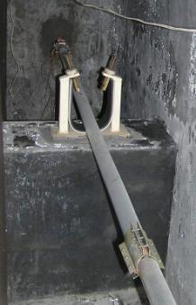
The free end of the quartz tube with two capacitive transducers.
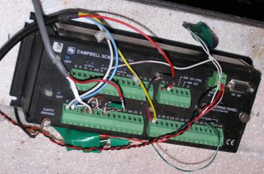 |
datalogger
Web page of the Department of Earth Science Institute SAS
 Tidal Station Vyhne
GPS coordinates:
48° 29′ 52″ N, 18° 49′ 44″ E
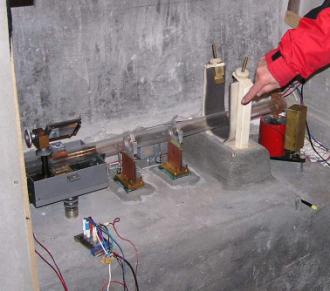
Our department operates a tidal station in Vyhne. The tidal station is located underground, in the gallery of St. Anthony of Padua in the Vyhne valley, Štiavnické vrchy Mts., Central Slovakia. Currently, it is equipped with quartz tube extensometer measuring the long-periodic (Earth's tides, annual temperature variations etc.) and aperiodic (tectonic) deformations of the Earth's crust. Since the end of 2005 the station is equipped with an α–particle counter to monitor the Radon emanation. In the beginning of 2006, a radio-frequency telemetric link connecting the seismological and tidal stations was established. With the satellite data connection of the seismic station Vyhne with the headquarters of the Geophysical Institute provided earlier, the data route from the tidal station's datalogger to our Bratislava workplace is now complete. Thus, the data acquisition process can be controlled better and the dropouts of data are prevented or minimized.
Situation map of the site of the Vyhne Tidal Station.
Situation map within the Štiavnické vrchy Mts.
The free end of the quartz tube with two capacitive transducers.
| |
datalogger