Introduction
Joint monitoring and interpretation of crustal deformations and temporal gravity changes observed on the surface in volcanic areas contributes valuable insights into the very complex underground physical and chemical processes associated with magmatic and/or hydrothermal systems. Temporal gravity changes are sensitive to subsurface mass transport and to temporal changes in the subsurface density distribution. They can detect such changes and processes at depth often prior to any other precursors of unrest. Therefore their monitoring and interpretation should be indispensable in mid- or long-term hazard assessment. The role of gravity changes in volcano monitoring and risk mitigation programs become particularly important in caseswhere the subsurface processes are accompaniedwith no measurable deformations.
Methodology
The inversion of gravity changes by the method of local corrections consists of two main steps: (1) approximation of the sources (subsurface mass/density changes) by 3D line segments; and (2) the inversion based on the local corrections resulting in sources represented by 3D star-convex bodies. The methodology has been decribed mathematically in detail in (Prutkin et al., 2011, and Vajda et al., 2012).
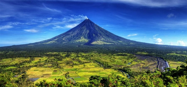
Mayon stratovolcano
Mayon is one of the most active volcanoes in the Philippines. This stratovolcano is part of the Bicol volcanic chain on the Luzon Island. It has a nearly perfect conical shape with a summit elevation in the range of 2460 m. Mayon's edifice was formed through alternate pyroclastic and lava flows. Its lava varies from basalts through basaltic andesites into the andesitic region. The volcano seems to have been erupting in three distinct modes: (1) frequent effusive eruptions (with or without an early Plinian eruption); (2) frequent weak to moderately explosive Strombolian eruptions; and (3) less frequent explosive Vulcanian eruptions. Longer repose periods of about 10 years lead to more explosive eruptions at Mayon, while shorter repose periods (of about 18 to 26 months) yield to more moderate activity.
Observations
Our study is carried out on gravity changes and vertical surface displacements observed in 5 campaigns between 1992 and 1996: 12/1992, 05/1993, 05/1994, 12/1994, and 12/1996 (Jentzsch et al., 2001, Sec. 3). Of these we only interpret campaign differences “4–1” (Dec/1994–Dec/1992) and “3–1” (May/1994–Dec/1992). Vertical displacements were compiled as campaign differences of benchmark heights observed using differential GPS (Völksen and Seeber, 1995). While significant gravity changes up to 150 μGal were observed,
vertical displacements were all within the measurement error (1 sigma) of ±4 cm. Residual gravity changes, indicative of the subsurface mass transport and density changes associated with magma and/or related hydrothermal fluids, are obtained after removing hydrological signal and the effect induced by surface vertical displacements. Due to the statistical insignificance of the observed vertical displacements over the given campaigns, it is assumed that the volcano edifice did not deform.

Fig. 1. Mayon topography and location of gravity benchmarks (shown as red triangles). Horizontal axis is longitude, and vertical is latitude.
Inversion results
Gravity changes for campaigns 3–1 and 4–1 were inverted by means of the method of local corrections. The inversion yields nearly spherical, ellipsoidal homogenous bodies representing a volumetric space (body) of a constant density change. In our inversion procedure, the value of the density change has to be selected apriori. This can be done only based on a hypothesis that relies on additional geoscientific (geophysical and/or geological) knowledge/findings. We assumed here a density change of 300 kg/m3. Taking into account the complexity of magmatic/hydrothermal systems, it is clear that our solution will represent
quite a simplification of the real sources. Nevertheless, it can serve as a useful proxy on the underground process. From the viewpoint of the inversion method, once the value of the density change is fixed (preselected), the resulting 3D geometry of the source body becomes a unique solution.

Fig. 2. The line segments approximating the sources of density changes generating the residual gravity changes at Mayon for campaigns 3–1 and 4–1, and the respective nearly-spherical ellipsoidal bodies representing the volume of homogenous density change preselected as 300 kg/m3. Horizontal axis is easting, and vertical axis is depth (km).
Conclusions
The residual gravity changes were first inverted in terms of sources represented by 3D line segments (Fig. 2). The line segment approximation facilitates the second step of the iterative non-linear inversion based on local corrections. In the second step, the residual gravity changes were inverted in terms of 3D star-convex homogenous bodies representing sources of subsurface mass/density changes. Based on geological and geochemical constraints, we assumed that the process leading to the observed positive residual gravity changes was mass transport, namely reinjection of fresh magma into the voids of the existing shallow magma system, from deep below. The absence of significant deformation accompanying the gravity changes indicates that this shallow magmatic system must have been nearly open during 1992–1996, i.e., has not behaved as a source of dilation. Inversion results for campaign differences 3–1 and 4–1 are presented. For campaign difference 3–1 the inversion results in a source body located about 2 km west of the volcano summit at a depth of 4.5 km (± 0.3 km) below sea level, with mass of injected magma of 34.97 (± 9.8) × 1010 kg (0.35 ± 0.10 MU). For campaign difference 4–1 the inversion results in a similar source body, located at a depth of 4.3 km (± 0.3 km), with magma influx of 12.49 (± 3.5) × 1010 kg (0.12 ± 0.04 MU).
Our inversion method is suitable for tracking mass changes, and their temporal evolution, based on observed (compiled) residual gravity changes. To transform the results of mass changes into information on mass transport and/or density changes, or even on the nature and parameters of dynamic processes associated with magma and hydrothermal fluids in volcanic areas, is impossible based solely on microgravimetric interpretation. Additional, even plentiful, geoscientific constraining information must be available and employed to provide such clues.
References
Jentzsch, G., Punongbayan, R.S., Schreiber, U., Seeber, G., Völksen, C.,Weise, A., 2001. Mayon volcano, Philippines: change of monitoring strategy after microgravity and GPS measurements from 1992 to 1996. Journal of Volcanology and Geothermal Research 109, 219–234
Prutkin, I., Vajda, P., Tenzer, R., Bielik, M., 2011. 3D inversion of gravity data by separation of sources and the method of local corrections: Kolarovo gravity high case study. Journal of Applied Geophysics 75 (3), 472–478, http://dx.doi.org/10.1016/j.jappgeo.2011.08.012
Vajda Peter, Ilya Prutkin, Robert Tenzer, and Gerhardt Jentzsch, 2012. Inversion of temporal gravity changes by the method of local corrections: A case study from Mayon volcano, Philippines. Journal of Volcanology and Geothermal Research 241–242 (2012): 13–20
Völksen, C., Seeber, G., 1995. Establishment of a GPS based control network at Mayon volcano. Cahier du Centre Européen de Geodynamique et de Seismologie: Proc. of the Workshop: New Challenges for Geodesy in Volcanoes Monitoring. June 14–16, 1993, Walferdange, Luxembourg, Vol. 8, 99–113