 |
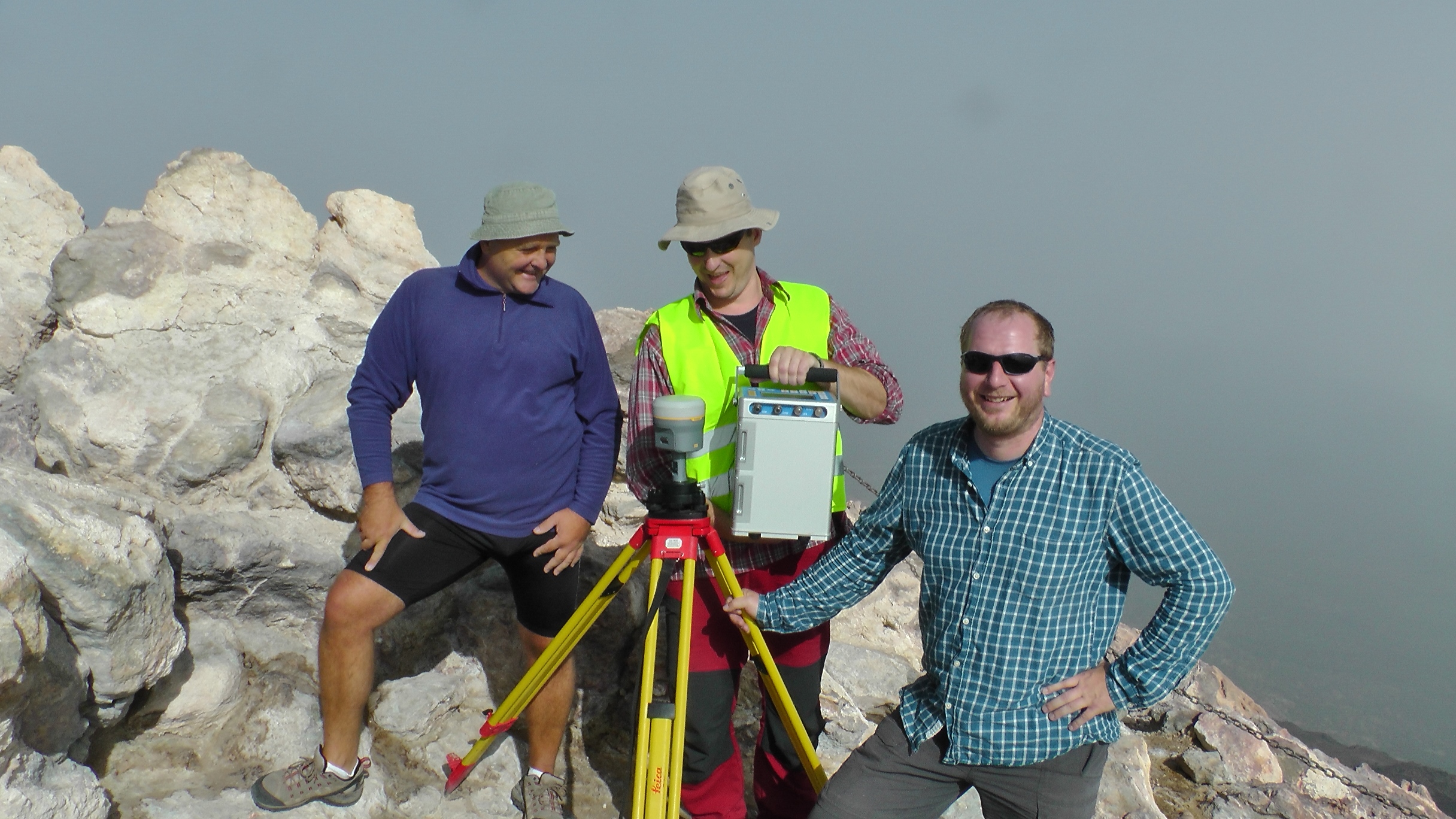
| The crew at observing on the summit of Teide (3718 m a.s.l.). |
 |
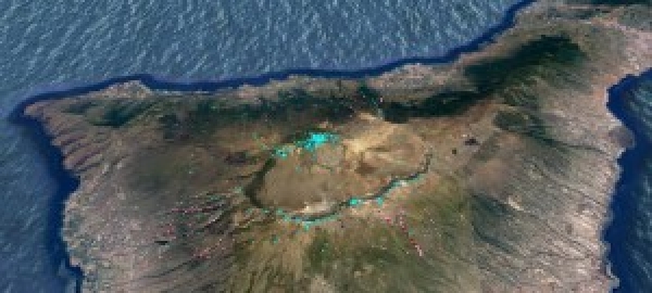
| Numerically predicted extreme values of the VGG on Tenerife. Shades of blue are high values, shades of red are low values |
The VGG is a highly variable quantity. It changes with the position of a benchmark (point) in the context of the surrounding terrain. Especially in alpine or rugged mountainous topography the values of VGG can vary abruptly and significantly (1). The VGG is a quantity that enters several computations in geodetic, geophysical, and geodynamic applications and approaches. We were concerned particularly with its use in volcano gravimetry for purposes of inverting and interpreting temporal (time-lapse) gravity changes observed during volcanic unrest at dormant or re-awakening volcanoes. Last year we published the results of our numerical study (2), which has proved that the contribution of the nearby topographic masses to the VGG can cause its variability as high as 80 % in a relative sense. Such variability cannot be ignored or neglected in a number of geophysical studies, which, in case of absence of knowledge of the true VGG use the constant value of the Free Air Gradient. In our study we have shown a better approximation is the topo-corrected VGG, in which the effect of the topographic masses on the gradient is computed with the use of high quality high resolution DEM and evaluation of the topo-effect by means of the TOPOSK software (3).
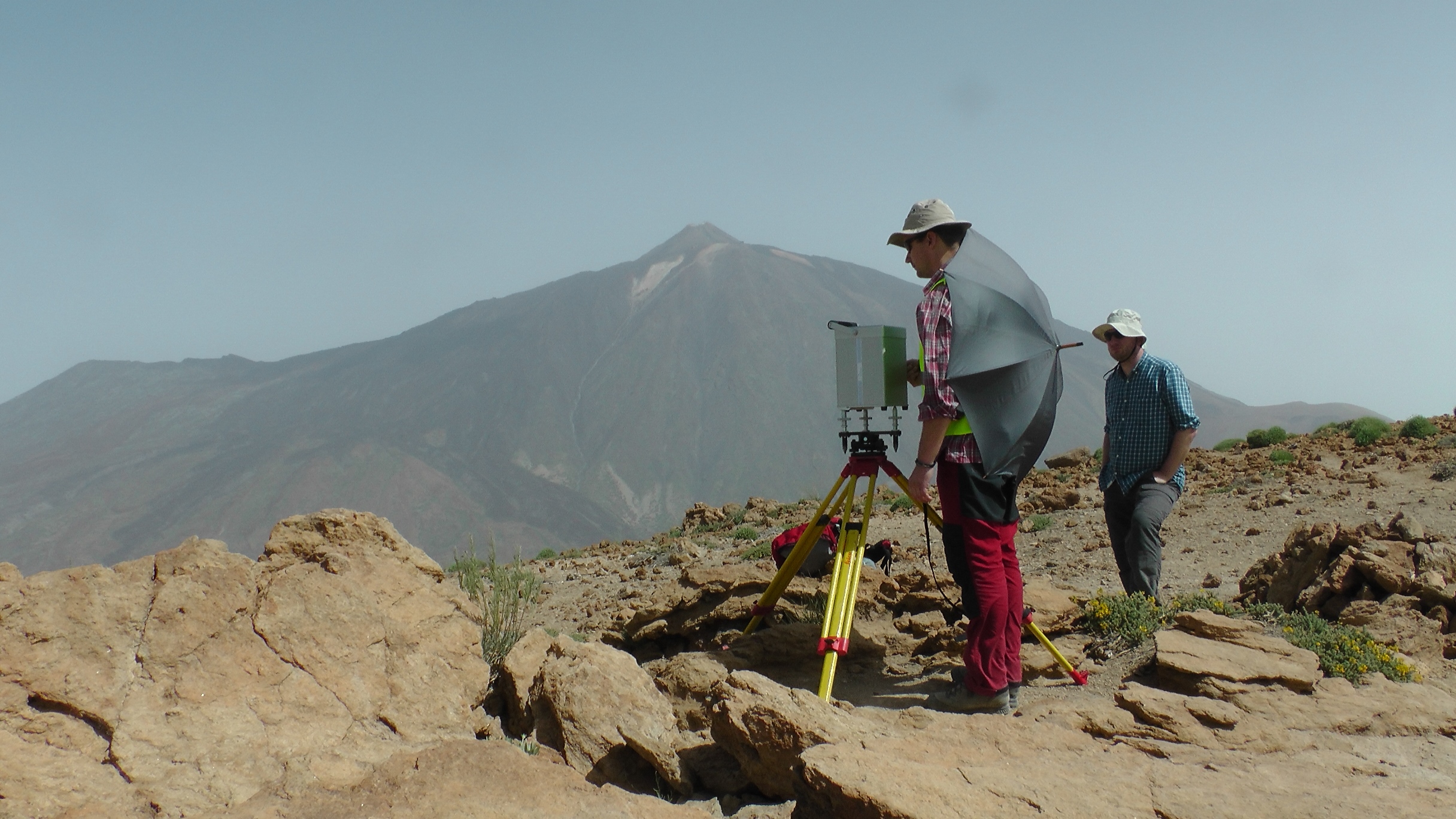 |
| VGG observation at the caldera rim on top of Mt. Guajara (2718 m a.s.l.). In the background is Teide and to the left Pico Viejo with its summit crater. The umbrella is used to shade the meter from the blowing wind. |
We chose the Central Volcanic Complex (CVC) of Tenerife, consisting of a caldera at about 2000 m a.s.l. and the twin stratovolcanoes Teide (3718 m a.s.l.) and Pico Viejo as our case study region. The reason was twofold. In a preceding study (4) we interpreted temporal (time-lapse) gravity changes observed at the CVC during the unrest of 2004-2005. Our study concluded that this unrest was a failed eruption with a magma intrusion into the NW part of the caldera at about 6 km below sea level. Deformation induced topographic effects need be accounted for when interpreting gravity changes. The effect induced by the vertical displacement of benchmark in ambient gravity field depends on the VGG. Second, we have modelled the topo-contribution to the VGG, and predicted the true VGGs numerically, for Tenerife. The goal of the field work was to verify these numerical predictions, especially the extreme values, in situ.
High extreme values (in absolute sense, the minus sign indicating the direction of the gradient) of the VGG are encountered at sharp convex relief features such as peaks or caldera rims. We took a reading of a high value at -506 microGal/m. Low values are found in canyons, troughs, gullies and karst- or sink-holes. We managed to get as low a value as -125 microGal/m. We have chosen the observation points beforehand, based on numerical predictions of extreme values. We obtained high values on top of Teide (3718 m a.s.l.) and on the Las Caňadas caldera rim, on top of Mt. Guajara (2718 m a.s.l.). We were hunting for low VGGs in sharp deep canyons of the Caňadas edifice remnants. We were not able to access some of our planned observation points in the canyons, as we would need to rappel and jumar to get to them, while we were not equipped with climbing gear.
 |
| In the canyons the greatest challenge was the lack of GNSS signal and the local hunters shooting at everything that moved. |
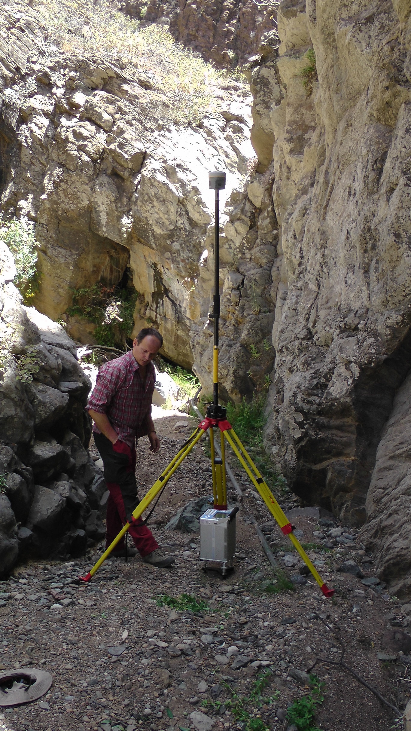
Measurements were conducted with a relative gravimeter (Scintrex CG5) and a GNSS (GPS) apparatus. VGGs were measured in a tower mode, on the point on ground and at an altitude of roughly 1 meter above the ground on a geodetic tripod with an optical tribrach. The points were accurately geodetically positioned by GNSS observations either in RTK or in static regime. The observation sessions at each point took from one to several hours. To access the points took often even longer time. We used a SUV vehicle to transport ourselves to the points, as well as hiked in tough terrain to access the points. The reward for our sweat was to scale the unique volcanic vistas, breathtaking scenic views, joy of being in the field and observe, and last but not least the acquired data which seem at the first glance to fit well our numerical predictions. We plan to publish the results in a renowned geophysical journal.
Acknowledgements: We are grateful to the Department of Geodesy of the STU in Bratislava that made the gravimeter and the GNSS equipment available to us, and particularly to Juraj Papčo, who took part in the campaign and was in charge of the geodetic observations. Our thanks go also to Jorge Pereda de Pablo of the Centro Geofísico de Canarias, IGN in Santa Cruz de Tenerife, and Sergio Sainz-Maza of the Observatorio Geofísico Central, IGN in Madrid, who helped us a lot with logistics and the permits for the Teide National park and the Corona Forestal park.
References:
- Zahorec P., Papčo J., Mikolaj M., Pašteka R., Szalaiová V., 2014: Role of near topography and building effects in vertical gravity gradients approximation. First Break, 32(1): 65–71
- Vajda P., Zahorec P., Papčo J., Kubová A., 2015. Deformation induced topographic effects in inversion of temporal gravity changes: First look at Free Air and Bouguer terms. Contributions to Geophysics and Geodesy 45(2): 149–171, doi: 10.1515/congeo-2015-0018
- Marušiak I., Zahorec P., Papčo J., Pašteka R., Mikuška R., 2013: Toposk, program for terrain corrections calculation, program guide. Manuscript, G-trend Ltd. (in Slovak)
- Prutkin Ilya, Peter Vajda, Jo Gottsmann, 2014. The gravimetric picture of magmatic and hydrothermal sources driving hybrid unrest on Tenerife in 2004/5. Journal of Volcanology and Geothermal Research, 282: 9–18, doi 10.1016/j.jvolgeores.2014.06.003
Text: Peter Vajda
Photos: Juraj Papčo and Peter Vajda
More details on site
http://www.geo.sav.sk/en/volcano-gravimetric-observations-on-tenerife/
![]() Video trailer
Video trailer